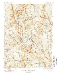
1949 Map of Roxbury
USGS Topo · Published 1949About this map
The Shepaug River carves a dramatic path through this Litchfield County landscape, creating distinctive landforms like The Clam Shell and Steep Rock north of Roxbury Sta. The mid-century era is defined by the operational New York New Haven and Hartford railroad, which follows the riverbank past Mine Hill and down toward Roxbury Falls. This industrial and transit corridor contrasts with the high ridges of Painter Hill and Booth Hill, where the Roxbury Fire Tower stands as a sentinel over the upland terrain.
Find a feature on this map
78 named features on this map. Tap any name to fly to it.
Don’t see what you’re looking for? This feature index may not catch every label — zoom into the map to look around manually.
Map Details
Editions of this 1949 Roxbury Map
2 editions found
Other maps of this area

1889 · Derby
USGS Topo · 1:62,500

1891 · Derby
USGS Topo · 1:62,500

1892 · Danbury
USGS Topo · 1:62,500

1892 · New Milford
USGS Topo · 1:62,500

1893 · Waterbury
USGS Topo · 1:62,500

1893 · New Milford
USGS Topo · 1:62,500

1893 · Derby
USGS Topo · 1:62,500

1904 · New Milford
USGS Topo · 1:62,500

1904 · Waterbury
USGS Topo · 1:62,500

1904 · Litchfield
USGS Topo · 1:125,000