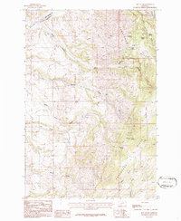
1986 Map of Roy Gulch
USGS Topo · Published 1986About this map
The Horseshoe Hills dominate this portion of the Montana landscape, defining a series of deeply etched drainages that flow toward the northern and southern boundaries. High-elevation features like Ellison Flat provide a stark contrast to the intricate network of gulches, including Roy Gulch, Garden Gulch, and Home Gulch, which suggest a long history of water-driven erosion and seasonal runoff. The boundary between Broadwater and Gallatin counties cuts across the northwest corner near Sixteenmile Creek, a primary waterway in this rugged ranching and timber environment.
Find a feature on this map
20 named features on this map. Tap any name to fly to it.
Don’t see what you’re looking for? This feature index may not catch every label — zoom into the map to look around manually.
Map Details
Editions of this 1986 Roy Gulch Map
This is the sole edition of this map. No revisions or reprints were ever made.
Other maps of this area

1886 · Fort Logan
USGS Topo · 1:250,000

1888 · Three Forks
USGS Topo · 1:250,000

1894 · Three Forks
USGS Topo · 1:250,000

1895 · Three Forks
USGS Topo · 1:250,000

1947 · Bozeman
USGS Topo · 1:250,000

1948 · Bozeman
USGS Topo · 1:250,000

1948 · White Sulphur Springs
USGS Topo · 1:250,000

1949 · Manhattan
USGS Topo · 1:62,500

1949 · Maudlow
USGS Topo · 1:62,500

1949 · Toston
USGS Topo · 1:62,500