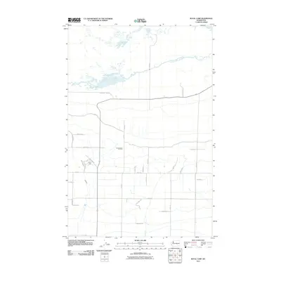
2011 Map of Royal Camp
USGS Topo · Published 2011About this map
The small settlement of Royal Camp serves as a focal point in this agricultural landscape of Grant County, Washington. At this time in the early 21st century, the area is defined by a strictly geometric grid of rural roads, including Frenchman Hills Rd and Division Rd S, which facilitate the region's sophisticated irrigation network. The presence of the Frenchman Hills Wasteway and the Crab Creek Lateral illustrates the vital role of water management in sustaining these high-desert farming communities. For those researching local heritage or genealogy, the Pleasant Valley Cemetery remains a significant landmark along Road 11 SE. The map layout reveals a transition from the structured residential clusters near Christensen Rd and 1st Ave to the expansive, irrigated tracts that characterize the Columbia Basin project's reach.
Find a feature on this map
30 named features on this map. Tap any name to fly to it.
Don’t see what you’re looking for? This feature index may not catch every label — zoom into the map to look around manually.
Map Details
Editions of this 2011 Royal Camp Map
This is the sole edition of this map. No revisions or reprints were ever made.
Other maps of this area

1910 · Winchester
USGS Topo · 1:62,500

1911 · Red Rock
USGS Topo · 1:62,500

1912 · Moses Lake
USGS Topo · 1:62,500

1923 · Corfu
USGS Topo · 1:62,500

1950 · Smyrna
USGS Topo · 1:62,500

1951 · Smyrna
USGS Topo · 1:62,500

1951 · Corfu
USGS Topo · 1:62,500

1953 · Walla Walla
USGS Topo · 1:250,000

1953 · Ritzville
USGS Topo · 1:250,000

1956 · Moses Lake South
USGS Topo · 1:24,000