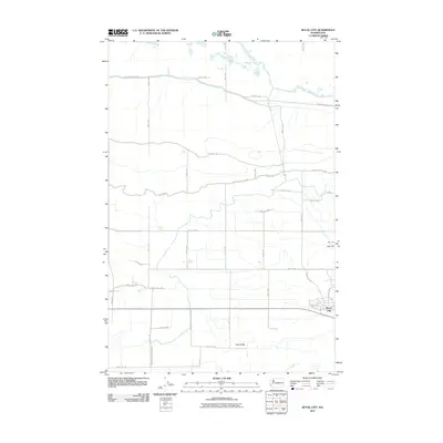
2011 Map of Royal City
USGS Topo · Published 2011About this map
Royal City occupies the southeastern corner of this map, serving as a hub for the agricultural operations that define this part of Grant County. The surrounding landscape is dominated by a systematic grid of roads and water management features essential to the region's irrigation-based economy. To the north, the Frenchman Hills Wasteway cuts across the terrain, while the Royal Branch Canal Wasteway drains towards the south. The topography is largely defined by the gradual drop of the Royal Slope Rd SW, broken only by the rise of Cash Butte in the southern portion of the quadrangle. The naming of thoroughfares like Frenchman Hills Rd and Ahlers Rd reflects the utilitarian but vital connection between the town and its outlying fields. This 2011 survey illustrates a mature water infrastructure system where every canal and road serves the productivity of the Columbia Basin.
Find a feature on this map
31 named features on this map. Tap any name to fly to it.
Don’t see what you’re looking for? This feature index may not catch every label — zoom into the map to look around manually.
Map Details
Editions of this 2011 Royal City Map
This is the sole edition of this map. No revisions or reprints were ever made.
Other maps of this area

1909 · Quincy
USGS Topo · 1:62,500

1910 · Quincy
USGS Topo · 1:62,500

1910 · Winchester
USGS Topo · 1:62,500

1911 · Red Rock
USGS Topo · 1:62,500

1912 · Beverly
USGS Topo · 1:62,500

1950 · Smyrna
USGS Topo · 1:62,500

1951 · Smyrna
USGS Topo · 1:62,500

1953 · Walla Walla
USGS Topo · 1:250,000

1953 · Ritzville
USGS Topo · 1:250,000

1954 · Beverly NE
USGS Topo · 1:24,000