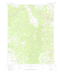
1959 Map of Royal Gorge
USGS Topo · Published 1966About this map
The Arkansas River carves a dramatic course through the McIntyre Hills on this 1959 survey, anchored by the engineering marvel of the Royal Gorge. While the Denver and Rio Grande Western Railroad follows the river's edge, the map also captures several vanished points of interest, including Sunset City (Site), Yorkville (Site), and Galena (Site). These sites, alongside the Adamic Cow Camp, speak to the ephemeral nature of early mining and ranching outposts in this portion of the San Isabel National Forest.
Find a feature on this map
90 named features on this map. Tap any name to fly to it.
Don’t see what you’re looking for? This feature index may not catch every label — zoom into the map to look around manually.
Map Details
Editions of this 1959 Royal Gorge Map
3 editions found

Other maps of this area

1889 · Canon City
USGS Topo · 1:125,000

1892 · Canon City
USGS Topo · 1:125,000

1894 · Pikes Peak
USGS Topo · 1:125,000

1901 · Pikes Peak
USGS Topo · 1:125,000

1942 · Cover Mtn.
USGS Topo · 1:62,500

1948 · Cover Mtn.
USGS Topo · 1:62,500

1954 · Cooper Mountain
USGS Topo · 1:24,000

1954 · Mount Tyndall
USGS Topo · 1:24,000

1954 · Pueblo
USGS Topo · 1:250,000

1955 · Westcliffe
USGS Topo · 1:24,000