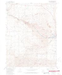
1980 Map of Royal Gorge
USGS Topo · Published 1981About this map
Royal Gorge and its surrounding canyons dominate this Colorado landscape during the early 1980s. The map illustrates the dramatic engineering and recreational infrastructure of the era, centered on the Royal Gorge Bridge and the supporting facilities of Royal Gorge Park. Near the gorge rim, the Miniature Railroad and various picnic areas highlight the area's development as a destination. To the southeast, the urban edge of Canon City is visible, featuring specialized utility infrastructure such as the Filtration Plant, Hydraulic Ditch, and a Gaging Sta along the river.
Find a feature on this map
44 named features on this map. Tap any name to fly to it.
Don’t see what you’re looking for? This feature index may not catch every label — zoom into the map to look around manually.
Map Details
Editions of this 1980 Royal Gorge Map
3 editions found
Other maps of this area

1889 · Canon City
USGS Topo · 1:125,000

1892 · Canon City
USGS Topo · 1:125,000

1894 · Pikes Peak
USGS Topo · 1:125,000

1901 · Pikes Peak
USGS Topo · 1:125,000

1942 · Cover Mtn.
USGS Topo · 1:62,500

1948 · Cover Mtn.
USGS Topo · 1:62,500

1954 · Cooper Mountain
USGS Topo · 1:24,000

1954 · Pueblo
USGS Topo · 1:250,000

1957 · Pueblo
USGS Topo · 1:250,000

1958 · Pueblo
USGS Topo · 1:250,000