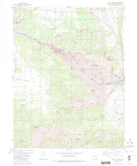
1980 Map of Royal Gorge
USGS Topo · Published 1984About this map
The Arkansas River carves a dramatic path through the Royal Gorge, serving as the central axis for this 1980 survey of Fremont County. The engineering feats of the era are on full display, from the iconic Royal Gorge Bridge spanning the canyon to the Denver and Rio Grande Western Railroad following the riverbanks. Tourism and recreation infrastructure define the landscape around Royal Gorge Park, featuring a Miniature RR, an Inclined RR, and numerous picnic areas. On the eastern edge, Canon City shows early signs of water management and utility development with the Hydraulic Ditch and a Filtration Plant. This map provides a unique look at the transition between industrial rail transport and the rising prominence of automotive travel along Skyline Drive, while preserving the locations of remote outposts like Adamic Cow Camp and the frontier-themed Buckskin Joe settlement.
Find a feature on this map
54 named features on this map. Tap any name to fly to it.
Don’t see what you’re looking for? This feature index may not catch every label — zoom into the map to look around manually.
Map Details
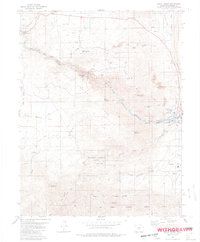
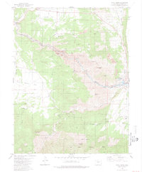
Editions of this 1980 Royal Gorge Map
3 editions found
Other maps of this area

1889 · Canon City
USGS Topo · 1:125,000

1892 · Canon City
USGS Topo · 1:125,000

1894 · Pikes Peak
USGS Topo · 1:125,000

1901 · Pikes Peak
USGS Topo · 1:125,000

1942 · Cover Mtn.
USGS Topo · 1:62,500

1948 · Cover Mtn.
USGS Topo · 1:62,500

1954 · Cooper Mountain
USGS Topo · 1:24,000

1954 · Pueblo
USGS Topo · 1:250,000

1957 · Pueblo
USGS Topo · 1:250,000

1958 · Pueblo
USGS Topo · 1:250,000