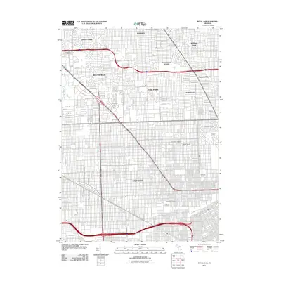
2011 Map of Royal Oak
USGS Topo · Published 2011About this map
Detroit and its northern suburbs are meticulously detailed in this early 21st-century survey, showcasing the dense residential and educational fabric of southeastern Michigan. The map highlights a significant cluster of academic institutions including the University of Detroit and the Muhammad University of Islam, alongside private schools like the University of Detroit Jesuit. The landscape is defined by its strictly planned grid and major thoroughfares such as W 10 Mile Rd and Greenfield Rd, which connect established residential enclaves like Huntington Woods and Lathrup Village. A series of prominent burial grounds, including Machpelah Cemetery and Woodlawn Cemetery, provides large green spaces amidst the urban sprawl. This study captures the region's post-war suburban development patterns, from the winding residential lanes of Southfield to the tightly packed blocks of Ferndale and Oak Park.
Find a feature on this map
129 named features on this map. Tap any name to fly to it.
Don’t see what you’re looking for? This feature index may not catch every label — zoom into the map to look around manually.
Map Details
Editions of this 2011 Royal Oak Map
This is the sole edition of this map. No revisions or reprints were ever made.
Other maps of this area

1905 · Wayne
USGS Topo · 1:62,500

1905 · Detroit
USGS Topo · 1:62,500

1907 · Pontiac
USGS Topo · 1:62,500

1908 · Rochester
USGS Topo · 1:62,500

1912 · Wayne
USGS Topo · 1:62,500

1918 · Detroit
USGS Topo · 1:62,500

1924 · Detroit
USGS Topo · 1:62,500

1934 · Detroit
USGS Topo · 1:62,500

1936 · Warren
USGS Topo · 1:31,680

1936 · Inkster
USGS Topo · 1:31,680