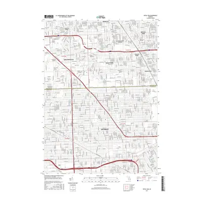
2017 Map of Royal Oak
USGS Topo · Published 2017About this map
Woodward Ave serves as the central spine for this dense metropolitan corridor, connecting the northern suburbs of Royal Oak, Berkley, and Southfield directly into the heart of Detroit. The map illustrates a landscape defined by its educational and religious institutions, including the Univ of Detroit Mercy and Marygrove Coll in the south, and Lawrence Technological Univ to the northwest. The presence of specialized centers such as the Yeshiva Gedolah of Greater Detroit and the Michigan Jewish Institute highlights the area's diverse cultural and community infrastructure. This modern survey captures the fully developed grid of the Oakland and Wayne County line, where major thoroughfares like the John C Lodge Expy and James Couzens Fwy facilitate heavy regional transit between residential enclaves like Lathrup Village and Pleasant Ridge. Large green spaces are primarily accounted for by historic memorial grounds, notably Woodlawn Cem and Forest Hill Cem.
Find a feature on this map
50 named features on this map. Tap any name to fly to it.
Don’t see what you’re looking for? This feature index may not catch every label — zoom into the map to look around manually.
Map Details
Editions of this 2017 Royal Oak Map
This is the sole edition of this map. No revisions or reprints were ever made.
Other maps of this area

1905 · Wayne
USGS Topo · 1:62,500

1905 · Detroit
USGS Topo · 1:62,500

1907 · Pontiac
USGS Topo · 1:62,500

1908 · Rochester
USGS Topo · 1:62,500

1912 · Wayne
USGS Topo · 1:62,500

1918 · Detroit
USGS Topo · 1:62,500

1924 · Detroit
USGS Topo · 1:62,500

1934 · Detroit
USGS Topo · 1:62,500

1936 · Warren
USGS Topo · 1:31,680

1936 · Inkster
USGS Topo · 1:31,680