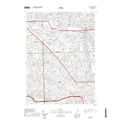
2023 Map of Royal Oak
USGS Topo · Published 2023About this map
The urban corridor of Oak Park, Southfield, and Royal Oak is documented here as it transitions across the Oakland Co and Wayne Co boundary. This landscape is characterized by a dense network of residential streets and educational institutions, including the University of Detroit Mercy and Marygrove College at the southern edge in Detroit. Significant burial grounds such as Evergreen Cem and Woodlawn Cem provide large green spaces amid the suburban development, while the unique circular road pattern of Lathrup Village stands out as a distinctive planned community layout near the Northwestern Hwy.
Find a feature on this map
46 named features on this map. Tap any name to fly to it.
Don’t see what you’re looking for? This feature index may not catch every label — zoom into the map to look around manually.
Map Details
Editions of this 2023 Royal Oak Map
This is the sole edition of this map. No revisions or reprints were ever made.
Other maps of this area

1905 · Wayne
USGS Topo · 1:62,500

1905 · Detroit
USGS Topo · 1:62,500

1907 · Pontiac
USGS Topo · 1:62,500

1908 · Rochester
USGS Topo · 1:62,500

1912 · Wayne
USGS Topo · 1:62,500

1918 · Detroit
USGS Topo · 1:62,500

1924 · Detroit
USGS Topo · 1:62,500

1934 · Detroit
USGS Topo · 1:62,500

1936 · Warren
USGS Topo · 1:31,680

1936 · Inkster
USGS Topo · 1:31,680