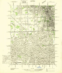
1936 Map of Royal Oak
USGS Topo · Published 1936About this map
Lathrup and Huntington Woods stand at the intersection of Oakland and Wayne counties during a period of rapid suburban expansion north of Detroit. This 1936 survey, compiled from aerial photographs by the Geological Survey, reveals a landscape transitioning from the agricultural drains of Mc Kinley Ditch and Hill Ditch to organized residential grids. The northern portion of the map is defined by prominent recreational and civic spaces, including the Detroit Zoological Park, Rackham Golf Course, and the Detroit Polo Club.
Find a feature on this map
110 named features on this map. Tap any name to fly to it.
Don’t see what you’re looking for? This feature index may not catch every label — zoom into the map to look around manually.
Map Details
Editions of this 1936 Royal Oak Map
This is the sole edition of this map. No revisions or reprints were ever made.
Other maps of this area

1905 · Wayne
USGS Topo · 1:62,500

1905 · Detroit
USGS Topo · 1:62,500

1907 · Pontiac
USGS Topo · 1:62,500

1908 · Rochester
USGS Topo · 1:62,500

1912 · Wayne
USGS Topo · 1:62,500

1918 · Detroit
USGS Topo · 1:62,500

1924 · Detroit
USGS Topo · 1:62,500

1934 · Detroit
USGS Topo · 1:62,500

1936 · Warren
USGS Topo · 1:31,680

1936 · Inkster
USGS Topo · 1:31,680