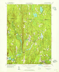
1954 Map of Royalston
USGS Topo · Published 1955About this map
Royalston and its surrounding hill country are captured here during the mid-1950s, a landscape defined by narrow valleys and the descent of the Lawrence Brook toward the Boston and Maine Railroad corridor. The geography is punctuated by significant water features, including the dramatic drops at Doane Falls and Spirit Falls, which historically provided the power for early industrial ventures in this corner of Worcester County. Smaller hamlets like West Royalston, Fryeville, and South Royalston are interconnected by rural routes such as Warwick Road and Royalston Road, showing a settlement pattern that remained focused on the accessible lowlands and stream crossings.
Find a feature on this map
66 named features on this map. Tap any name to fly to it.
Don’t see what you’re looking for? This feature index may not catch every label — zoom into the map to look around manually.
Map Details
Editions of this 1954 Royalston Map
3 editions found
Other maps of this area

1887 · Warwick
USGS Topo · 1:62,500

1887 · Winchendon
USGS Topo · 1:62,500

1889 · Warwick
USGS Topo · 1:62,500

1890 · Winchendon
USGS Topo · 1:62,500

1894 · Winchendon
USGS Topo · 1:62,500

1894 · Warwick
USGS Topo · 1:62,500

1898 · Monadnock
USGS Topo · 1:62,500

1898 · Keene
USGS Topo · 1:62,500

1932 · Warwick
USGS Topo · 1:48,000

1932 · Winchendon
USGS Topo · 1:48,000