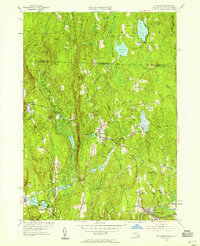
1954 Map of Royalston
USGS Topo · Published 1958About this map
Royalston serves as the central hub of this mid-century New England landscape, where the topography transition from the highlands of Cheshire County down toward the Millers River valley. The map documents a cluster of localized settlements like West Royalston, Fryeville, and Packard Heights before major modern development, reflecting a classic Worcester County pattern of river-adjacent industrial hamlets and upland farms. The hydrology of the area is particularly detailed, showing the Tully River system feeding into Tully Pond and the expansive waters of Laurel Lake near the state line.
Find a feature on this map
59 named features on this map. Tap any name to fly to it.
Don’t see what you’re looking for? This feature index may not catch every label — zoom into the map to look around manually.
Map Details
Editions of this 1954 Royalston Map
3 editions found
Other maps of this area

1887 · Warwick
USGS Topo · 1:62,500

1887 · Winchendon
USGS Topo · 1:62,500

1889 · Warwick
USGS Topo · 1:62,500

1890 · Winchendon
USGS Topo · 1:62,500

1894 · Winchendon
USGS Topo · 1:62,500

1894 · Warwick
USGS Topo · 1:62,500

1898 · Monadnock
USGS Topo · 1:62,500

1898 · Keene
USGS Topo · 1:62,500

1932 · Warwick
USGS Topo · 1:48,000

1932 · Winchendon
USGS Topo · 1:48,000