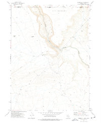
1973 Map of Rubber Hill
USGS Topo · Published 1977About this map
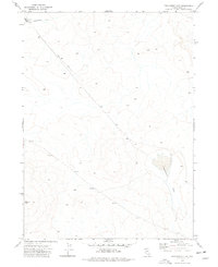
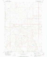
The South Fork Owyhee River cuts a deep path through the high plateau of the Y P Desert, straddling the border of Nevada and Idaho. This 1970s survey captures a landscape defined by its aridity and isolation, where water sources like Coyote Springs, Rubber Lake, and the Stateline Windmill represent vital infrastructure for the cattle ranching that defines the region. The presence of unnamed Ruins and a long Pipeline suggests a history of human adaptation to this environment, while local names like Rubber Hill and Devils Corral mark the distinctive topography of Elko and Owyhee counties. A network of Jeep Trails provides the only access through the winding canyons and open flats during this era.
Find a feature on this map
13 named features on this map. Tap any name to fly to it.
Don’t see what you’re looking for? This feature index may not catch every label — zoom into the map to look around manually.
Map Details
Editions of this 1973 Rubber Hill Map
This is the sole edition of this map. No revisions or reprints were ever made.
Other maps of this area

1955 · McDermitt
USGS Topo · 1:250,000

1955 · Jordan Valley
USGS Topo · 1:250,000

1957 · Jordan Valley
USGS Topo · 1:250,000

1958 · Jordan Valley
USGS Topo · 1:250,000

1959 · McDermitt
USGS Topo · 1:250,000
1973 · Coyote Hole
USGS Topo · 1:24,000
1973 · Bull Camp Butte
USGS Topo · 1:24,000
1973 · Star Valley Ridge East
USGS Topo · 1:24,000
1973 · Twelvemile Flat
USGS Topo · 1:24,000
1973 · Four Corners
USGS Topo · 1:24,000