
1973 Map of Twelvemile Flat
USGS Topo · Published 1977About this map
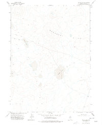
Twelvemile Flat characterizes this remote Elko County landscape, mapped during the early 1970s. The terrain is defined by its isolation and limited infrastructure, visible through the presence of a single Landing Strip and a long Jeep Trail that cuts diagonally across the topography. While much of the land remains open, specific points of human activity and named geography appear, such as the Star Valley Cabin in the northwest and the prominent Bartome Knoll to the southwest. This survey offers a clear view of a high-desert environment before modern development, capturing the essential landmarks used by ranchers and travelers in this part of Nevada.
Find a feature on this map
5 named features on this map. Tap any name to fly to it.
Don’t see what you’re looking for? This feature index may not catch every label — zoom into the map to look around manually.
Map Details
Editions of this 1973 Twelvemile Flat Map
This is the sole edition of this map. No revisions or reprints were ever made.
Other maps of this area

1955 · McDermitt
USGS Topo · 1:250,000

1959 · McDermitt
USGS Topo · 1:250,000
1973 · Star Valley Ridge East
USGS Topo · 1:24,000

1973 · Corral Lake
USGS Topo · 1:24,000
1973 · Rubber Hill
USGS Topo · 1:24,000
1973 · Star Valley Ridge SE
USGS Topo · 1:24,000
1974 · Twelvemile Flat SE
USGS Topo · 1:24,000

1974 · Desert Ranch
USGS Topo · 1:24,000
1977 · Silver Lake
USGS Topo · 1:24,000
1977 · State Line Camp
USGS Topo · 1:24,000