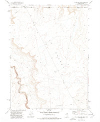
1977 Map of State Line Camp
USGS Topo · Published 1978About this map
South Fork Owyhee River cuts a deep, winding canyon through the high desert floor of this borderland region. Mapping in the late 1970s shows the sparsely populated intersection of Idaho and Nevada, where the boundary between Owyhee and Elko counties is marked across the open range. The landscape is dominated by the vast Y P Desert and the elevated plateau of Peterson Table. Human activity in this arid environment is centered on the State Line Camp, which is supported by a local Water Tank and a significant Pipeline traversing the northern section of the sheet. The terrain is characterized by intricate contour lines defining the river's erosional path and scattered Gravel Pits that suggest localized resource extraction in an otherwise remote livestock or transit corridor.
Find a feature on this map
9 named features on this map. Tap any name to fly to it.
Don’t see what you’re looking for? This feature index may not catch every label — zoom into the map to look around manually.
Map Details
Editions of this 1977 State Line Camp Map
2 editions found
Other maps of this area

1955 · McDermitt
USGS Topo · 1:250,000

1955 · Jordan Valley
USGS Topo · 1:250,000

1957 · Jordan Valley
USGS Topo · 1:250,000

1958 · Jordan Valley
USGS Topo · 1:250,000

1959 · McDermitt
USGS Topo · 1:250,000

1964 · Hat Peak
USGS Topo · 1:62,500

1971 · Juniper Basin
USGS Topo · 1:24,000

1973 · Bull Camp Butte
USGS Topo · 1:24,000
1973 · Rubber Hill
USGS Topo · 1:24,000

1973 · Twelvemile Flat
USGS Topo · 1:24,000