1974 Map of Twelvemile Flat SE
USGS Topo · Published 1977About this map
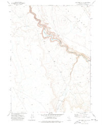
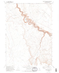
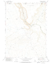
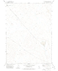
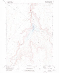
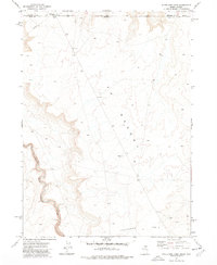
The South Fork Owyhee River cuts a deep, winding path through the high desert of Elko County, defining the central landscape of this 1974 survey. Rising above the river canyon, the Peterson Desert Table dominates the northeast, while the drainage of Fourmile Creek marks the southeastern reach. The map reveals a land utilized for seasonal livestock grazing rather than permanent settlement, evidenced by several Corral sites and a Water Tank located near the creek bed.
Find a feature on this map
9 named features on this map. Tap any name to fly to it.
Don’t see what you’re looking for? This feature index may not catch every label — zoom into the map to look around manually.
Map Details
Editions of this 1974 Twelvemile Flat SE Map
2 editions found
Other maps of this area

1955 · McDermitt
USGS Topo · 1:250,000

1959 · McDermitt
USGS Topo · 1:250,000
1964 · Hat Peak
USGS Topo · 1:62,500
1964 · Wilson Reservoir
USGS Topo · 1:62,500
1973 · Rubber Hill
USGS Topo · 1:24,000
1973 · Twelvemile Flat
USGS Topo · 1:24,000
1974 · Desert Ranch
USGS Topo · 1:24,000
1977 · Silver Lake
USGS Topo · 1:24,000
1977 · State Line Camp
USGS Topo · 1:24,000
1982 · Bull Run Mts
USGS Topo · 1:100,000