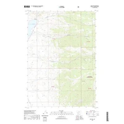
2020 Map of Ruby Dam
USGS Topo · Published 2020About this map
Ruby Dam controls the flow of the Ruby River at the northern edge of this high-elevation Montana landscape, forming the extensive Ruby River Reservoir. The area is characterized by a network of drainage systems including Davey Cr, Idaho Cr, and Jasmine Cr, which carve through the terrain to create landmarks like Barton Gulch and Dry Hollow. These natural features, along with Dark Hollow, define the topography as the land rises toward the Beaverhead National Forest in the southeast corner.
Find a feature on this map
24 named features on this map. Tap any name to fly to it.
Don’t see what you’re looking for? This feature index may not catch every label — zoom into the map to look around manually.
Map Details
Editions of this 2020 Ruby Dam Map
This is the sole edition of this map. No revisions or reprints were ever made.
Other maps of this area

1888 · Three Forks
USGS Topo · 1:250,000

1893 · Dillon
USGS Topo · 1:250,000

1894 · Three Forks
USGS Topo · 1:250,000

1895 · Three Forks
USGS Topo · 1:250,000

1947 · Bozeman
USGS Topo · 1:250,000

1948 · Bozeman
USGS Topo · 1:250,000

1949 · Varney
USGS Topo · 1:62,500

1950 · Virginia City
USGS Topo · 1:62,500

1955 · Bozeman
USGS Topo · 1:250,000

1955 · Dillon
USGS Topo · 1:250,000