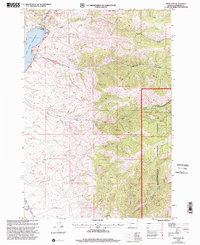
1997 Map of Ruby Dam
USGS Topo · Published 2002About this map
Ruby Dam anchors this landscape in the late twentieth century, holding back the Ruby River Reservoir along the western edge of the map. The geography reflects a mountain environment shaped by both conservation and extraction, with the eastern half dominated by the Beaverhead National Forest. Evidence of historical mining activity is preserved in the landscape through the presence of Dredge Tailings along Barton Gulch, as well as several labeled Mine and Prospects sites to the north. These features suggest an era of active mineral exploration and industrial dredging that predates the modern recreational focus of the Ruby Reservoir Campground. Ranching history is also represented at the Wonderly Ranch near the Upper Calloway Ditch Road, while the rugged drainage network includes Davey Creek, Idaho Creek, and the North Fork Greenhorn Creek.
Find a feature on this map
24 named features on this map. Tap any name to fly to it.
Don’t see what you’re looking for? This feature index may not catch every label — zoom into the map to look around manually.
Map Details
Editions of this 1997 Ruby Dam Map
This is the sole edition of this map. No revisions or reprints were ever made.
Other maps of this area

1888 · Three Forks
USGS Topo · 1:250,000

1893 · Dillon
USGS Topo · 1:250,000

1894 · Three Forks
USGS Topo · 1:250,000

1895 · Three Forks
USGS Topo · 1:250,000

1947 · Bozeman
USGS Topo · 1:250,000

1948 · Bozeman
USGS Topo · 1:250,000

1949 · Varney
USGS Topo · 1:62,500

1950 · Virginia City
USGS Topo · 1:62,500

1955 · Bozeman
USGS Topo · 1:250,000

1955 · Dillon
USGS Topo · 1:250,000