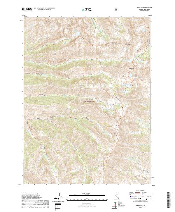
2021 Map of Ruby Dome
USGS Topo · Published 2021About this map
Ruby Dome and the high ridges of the Ruby Mountains dominate this high-altitude landscape within the Humboldt National Forest. This 2021 survey illustrates a wilderness defined by glacial cirques and alpine lakes, including Lamoille Lake and Echo Lake, which feed the headwaters of the Lamoille Cr and Thomas Cr. The map reveals a sophisticated network of backcountry access points, most notably the Ruby Crest National Recreation Trl which traverses the spine of the range past Liberty Pass and Wines Peak.
Find a feature on this map
59 named features on this map. Tap any name to fly to it.
Don’t see what you’re looking for? This feature index may not catch every label — zoom into the map to look around manually.
Map Details
Editions of this 2021 Ruby Dome Map
This is the sole edition of this map. No revisions or reprints were ever made.
Other maps of this area

1934 · Jiggs
USGS Topo · 1:125,000

1935 · Halleck
USGS Topo · 1:125,000

1937 · Jiggs
USGS Topo · 1:125,000

1955 · Elko
USGS Topo · 1:250,000

1958 · Elko
USGS Topo · 1:250,000

1959 · Jiggs
USGS Topo · 1:62,500

1962 · Elko
USGS Topo · 1:250,000

1962 · Lee
USGS Topo · 1:62,500

1962 · Lamoille
USGS Topo · 1:62,500

1965 · Elko
USGS Topo · 1:250,000