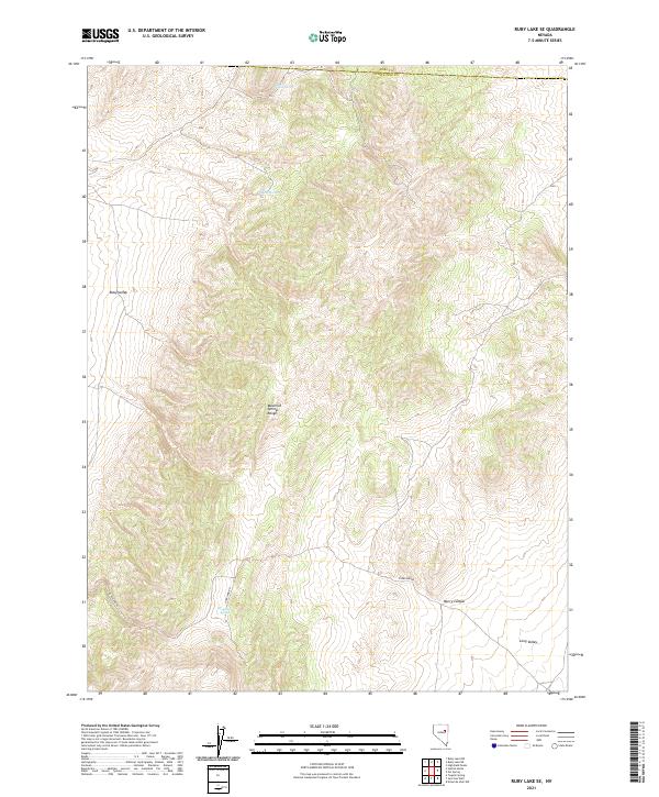
2021 Map of Ruby Lake SE
USGS Topo · Published 2021About this map
Maverick Springs Range dominates this portion of the high desert along the border of Elko and White Pine counties. This map details a remote landscape where water sources like Mountain Spring, Willow Spring, and Salas Spring dictated the routes of travel and early settlement patterns. The presence of Overland Rd cutting through the southern half of the quadrangle suggests its long-standing role as a corridor through the Great Basin, connecting the expansive Ruby Valley to the west with Long Valley to the east. The terrain is defined by deep draws such as Murry Canyon, illustrating the high-elevation drainage systems that characterize this part of Nevada. While largely unpopulated, the mapping of these specific named springs provides essential points of reference for local historians tracing the movement of people and livestock through these valleys.
Find a feature on this map
13 named features on this map. Tap any name to fly to it.
Don’t see what you’re looking for? This feature index may not catch every label — zoom into the map to look around manually.
Map Details
Editions of this 2021 Ruby Lake SE Map
This is the sole edition of this map. No revisions or reprints were ever made.
Other maps of this area

1955 · Elko
USGS Topo · 1:250,000

1956 · Ely
USGS Topo · 1:250,000

1958 · Elko
USGS Topo · 1:250,000

1959 · Ely
USGS Topo · 1:250,000

1962 · Elko
USGS Topo · 1:250,000

1963 · Ely
USGS Topo · 1:250,000

1965 · Elko
USGS Topo · 1:250,000
1968 · Ruby Lake SE
USGS Topo · 1:24,000
1968 · Ruby Lake NW
USGS Topo · 1:24,000

1968 · Ruby Lake NE
USGS Topo · 1:24,000