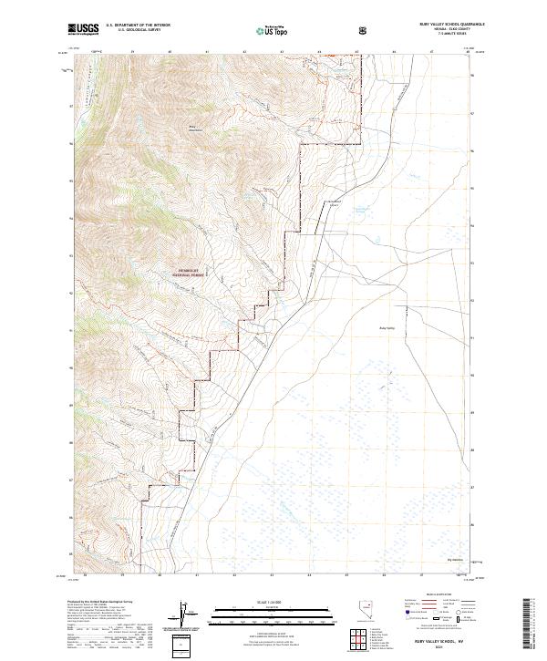
2021 Map of Ruby Valley School
USGS Topo · Published 2021About this map
Humboldt National Forest and the towering Ruby Mountains dominate the western portion of this landscape, where steep drainages like Lamoille Canyon and Thompson Creek descend into the high desert floor. The transition from the high peaks to the Ruby Valley is marked by a network of drainage-based trails and access roads, including the Colonel Moore North and Colonel Moore South routes.
Find a feature on this map
55 named features on this map. Tap any name to fly to it.
Don’t see what you’re looking for? This feature index may not catch every label — zoom into the map to look around manually.
Map Details
Editions of this 2021 Ruby Valley School Map
This is the sole edition of this map. No revisions or reprints were ever made.
Other maps of this area

1935 · Halleck
USGS Topo · 1:125,000

1955 · Elko
USGS Topo · 1:250,000

1958 · Elko
USGS Topo · 1:250,000

1962 · Elko
USGS Topo · 1:250,000

1962 · Lamoille
USGS Topo · 1:62,500

1965 · Elko
USGS Topo · 1:250,000

1968 · Franklin Lake NE
USGS Topo · 1:24,000
1969 · Franklin Lake NW
USGS Topo · 1:24,000
1984 · Ruby City Creek
USGS Topo · 1:24,000

1984 · West of Delcer Buttes
USGS Topo · 1:24,000