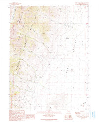
1990 Map of Ruby Valley School
USGS Topo · Published 1991About this map
The Humboldt National Forest and the Ruby Mountains dominate the western half of this Nevada landscape, where steep canyons descend into the broad Ruby Valley. This 1990 survey captures a rugged transition from high-altitude wilderness to a valley floor marked by water management and ranching infrastructure. The Ruby Valley Sch sits centrally near the mountain base, serving as a focal point for the surrounding rural area. Along the basin's edge, geothermal activity is evident at Sulphur Hot Springs, while high in the mountains, features like Watermelon Spring and Lamoille Canyon define the drainage patterns.
Find a feature on this map
41 named features on this map. Tap any name to fly to it.
Don’t see what you’re looking for? This feature index may not catch every label — zoom into the map to look around manually.
Map Details
Editions of this 1990 Ruby Valley School Map
This is the sole edition of this map. No revisions or reprints were ever made.
Other maps of this area

1935 · Halleck
USGS Topo · 1:125,000

1955 · Elko
USGS Topo · 1:250,000

1958 · Elko
USGS Topo · 1:250,000

1962 · Elko
USGS Topo · 1:250,000

1962 · Lamoille
USGS Topo · 1:62,500

1965 · Elko
USGS Topo · 1:250,000

1968 · Franklin Lake NE
USGS Topo · 1:24,000
1969 · Franklin Lake NW
USGS Topo · 1:24,000
1984 · Ruby City Creek
USGS Topo · 1:24,000

1984 · West of Delcer Buttes
USGS Topo · 1:24,000