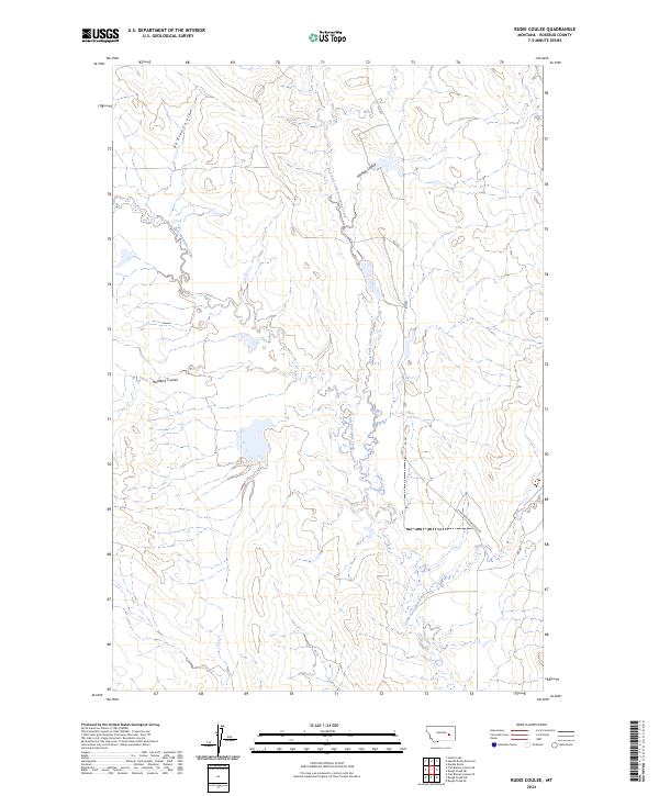
2024 Map of Rudie Coulee
USGS Topo · Published 2024About this map
Little Porcupine Creek and its primary tributaries dominate this portion of the Rosebud County landscape, illustrating a drainage system defined by intermittent watercourses and topographic breaks. The hydrology of the area is characterized by several named coulees, including Rudie Coulee in the northwest and Badland Coulee to the west, which channel seasonal runoff into the larger creek valley. The terrain is marked by the distinct paths of East Fork Little Porcupine Creek and Wildcat Coulee, which converge as they move toward the southern reaches of the quadrangle. Transport across this sparsely populated ranching country is facilitated by a network of rural routes, notably Little Porcupine Creek Rd and several numbered access roads like Rd 202. This contemporary survey highlights the enduring isolation of the Big Sky country, where geography is still largely defined by the township and range system and the natural flow of the local forks.
Find a feature on this map
14 named features on this map. Tap any name to fly to it.
Don’t see what you’re looking for? This feature index may not catch every label — zoom into the map to look around manually.
Map Details
Editions of this 2024 Rudie Coulee Map
This is the sole edition of this map. No revisions or reprints were ever made.
Other maps of this area

1954 · Forsyth
USGS Topo · 1:250,000

1957 · Forsyth
USGS Topo · 1:250,000

1958 · Forsyth
USGS Topo · 1:250,000

1965 · Needle Butte Reservoir
USGS Topo · 1:24,000

1965 · Needle Butte
USGS Topo · 1:24,000

1965 · Stellar Lake
USGS Topo · 1:24,000

1969 · Rudie Coulee
USGS Topo · 1:24,000

1969 · Flat Bottom Coulee NE
USGS Topo · 1:24,000
1969 · Rough Creek SE
USGS Topo · 1:24,000
1969 · Rough Creek SW
USGS Topo · 1:24,000