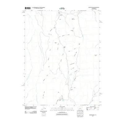
2011 Map of Rudolph Hill
USGS Topo · Published 2011About this map
Cebolla Creek carves a central path through this landscape, providing a vital water source for the scattered ranching operations that define the area's modern footprint. The presence of Sammons Ranch, Jardine Ranch, and Youmans Ranch indicates a continuing legacy of land use tied to the drainages of Rudolph Hill and Miller Hill. Settlement patterns are closely linked to these waterways, with the Smith Place and the Powderhorn Cemetery serving as important local landmarks for genealogical research.
Find a feature on this map
52 named features on this map. Tap any name to fly to it.
Don’t see what you’re looking for? This feature index may not catch every label — zoom into the map to look around manually.
Map Details
Editions of this 2011 Rudolph Hill Map
This is the sole edition of this map. No revisions or reprints were ever made.
Other maps of this area

1908 · Uncompahgre
USGS Topo · 1:125,000

1911 · Uncompahgre
USGS Topo · 1:125,000

1954 · Gateview
USGS Topo · 1:24,000

1956 · Montrose
USGS Topo · 1:250,000

1959 · Montrose
USGS Topo · 1:250,000

1960 · Montrose
USGS Topo · 1:250,000

1962 · Rudolph Hill
USGS Topo · 1:24,000

1962 · Powderhorn
USGS Topo · 1:24,000
1962 · Spring Hill Creek
USGS Topo · 1:24,000
1963 · Cannibal Plateau
USGS Topo · 1:24,000