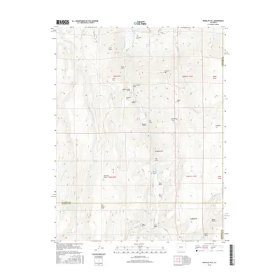
2016 Map of Rudolph Hill
USGS Topo · Published 2016About this map
Cebolla Cr and its many tributaries carve through this high-elevation landscape along the boundary of Gunnison, Hinsdale, and Saguache counties. The settlement of Cathedral occupies the southeastern portion of the map near Burnt Draw, while the northern reaches include the Powderhorn Cem. The terrain is defined by a dense network of gulches and ridges, including Swinehart Ridge and Fish Canyon Ridge, which separate high-altitude clearings like Horse Park, Johnson Park, and Dempsey Parks.
Find a feature on this map
58 named features on this map. Tap any name to fly to it.
Don’t see what you’re looking for? This feature index may not catch every label — zoom into the map to look around manually.
Map Details
Editions of this 2016 Rudolph Hill Map
This is the sole edition of this map. No revisions or reprints were ever made.
Other maps of this area

1908 · Uncompahgre
USGS Topo · 1:125,000

1911 · Uncompahgre
USGS Topo · 1:125,000

1954 · Gateview
USGS Topo · 1:24,000

1956 · Montrose
USGS Topo · 1:250,000

1959 · Montrose
USGS Topo · 1:250,000

1960 · Montrose
USGS Topo · 1:250,000

1962 · Rudolph Hill
USGS Topo · 1:24,000

1962 · Powderhorn
USGS Topo · 1:24,000
1962 · Spring Hill Creek
USGS Topo · 1:24,000
1963 · Cannibal Plateau
USGS Topo · 1:24,000