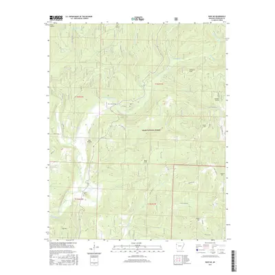
2017 Map of Rudy NE
USGS Topo · Published 2017About this map
Lee Creek defines this area of the Ozark National Forest in Crawford County, winding through a landscape of prominent peaks and family-named hollows. The settlement of Lee Creek serves as a central point for the surrounding highlands, which are marked by landmarks like Bald Knob, Bradford Knob, and Kimes Mtn. The topography is etched by numerous watercourses, including Elmo Cr, Blackburn Cr, and Whiskey Spring, which feed into local catchments like Swearingen Lake.
Find a feature on this map
54 named features on this map. Tap any name to fly to it.
Don’t see what you’re looking for? This feature index may not catch every label — zoom into the map to look around manually.
Map Details
Editions of this 2017 Rudy NE Map
This is the sole edition of this map. No revisions or reprints were ever made.
Other maps of this area

1898 · Winslow #4
USGS Topo · 1:62,500

1898 · Winslow #3
USGS Topo · 1:62,500

1898 · Winslow
USGS Topo · 1:125,000

1901 · Winslow
USGS Topo · 1:125,000

1946 · Fort Smith
USGS Topo · 1:250,000

1965 · Fort Smith
USGS Topo · 1:250,000

1967 · Fort Smith
USGS Topo · 1:250,000
1969 · Uniontown
USGS Topo · 1:24,000

1969 · Natural Dam
USGS Topo · 1:24,000
1969 · Mountainburg SW
USGS Topo · 1:24,000