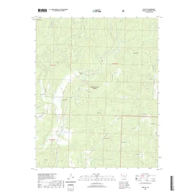
2020 Map of Rudy NE
USGS Topo · Published 2020About this map
Lee Creek defines the local geography of this Crawford County landscape, where the namesake settlement and waterway meet within the Ozark National Forest. The map documents a rugged interior network of rural routes, including the Old Cove City Rd and Old 12 Cross Roads, which weave between high points like Bradford Knob and Kimes Mtn. This modern survey provides crucial data for genealogists, marking several family and community burial grounds such as Oak Grove Cem, Bryant Cem, and Kimes Cem. Water resources are prevalent throughout the timbered hills, from the sequestered Whiskey Spring to Swearingen Lake and Switchback Lake. The terrain is characterized by numerous small drainages like Fall Cr and Buckhorn Cr, illustrating the complex watershed that feeds into the larger creek systems of western Arkansas.
Find a feature on this map
53 named features on this map. Tap any name to fly to it.
Don’t see what you’re looking for? This feature index may not catch every label — zoom into the map to look around manually.
Map Details
Editions of this 2020 Rudy NE Map
This is the sole edition of this map. No revisions or reprints were ever made.
Other maps of this area

1898 · Winslow #4
USGS Topo · 1:62,500

1898 · Winslow #3
USGS Topo · 1:62,500

1898 · Winslow
USGS Topo · 1:125,000

1901 · Winslow
USGS Topo · 1:125,000

1946 · Fort Smith
USGS Topo · 1:250,000

1965 · Fort Smith
USGS Topo · 1:250,000

1967 · Fort Smith
USGS Topo · 1:250,000
1969 · Uniontown
USGS Topo · 1:24,000

1969 · Natural Dam
USGS Topo · 1:24,000
1969 · Mountainburg SW
USGS Topo · 1:24,000