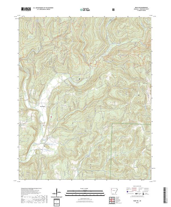
2024 Map of Rudy NE
USGS Topo · Published 2024About this map
The Ozark National Forest dominates this Crawford County landscape, where the waters of Lee Creek wind through a complex system of ridges and hollows. The terrain is defined by prominent elevations such as Bradford Knob and Kimes Mtn, while the waterway network is fed by numerous tributaries including Buckhorn Creek, Blackburn Creek, and Fall Creek. The map details an extensive modern trail system, including the West Outer Loop Trl and East Outer Loop Trl, which navigate the steep gradients of the forest. For those researching local heritage, the placement of Bryant Cem, Kimes Cem, and Kimbler Cem provides critical points of reference for early families in the region. The map also traces established routes like HWY 220 and Old 12 Cross Roads, alongside more localized paths like Pannell Rd and Creek Fork Rd that serve the small settlement at Lee Creek.
Find a feature on this map
60 named features on this map. Tap any name to fly to it.
Don’t see what you’re looking for? This feature index may not catch every label — zoom into the map to look around manually.
Map Details
Editions of this 2024 Rudy NE Map
This is the sole edition of this map. No revisions or reprints were ever made.
Other maps of this area

1898 · Winslow #4
USGS Topo · 1:62,500

1898 · Winslow #3
USGS Topo · 1:62,500

1898 · Winslow
USGS Topo · 1:125,000

1901 · Winslow
USGS Topo · 1:125,000

1946 · Fort Smith
USGS Topo · 1:250,000

1965 · Fort Smith
USGS Topo · 1:250,000

1967 · Fort Smith
USGS Topo · 1:250,000
1969 · Uniontown
USGS Topo · 1:24,000

1969 · Natural Dam
USGS Topo · 1:24,000
1969 · Mountainburg SW
USGS Topo · 1:24,000