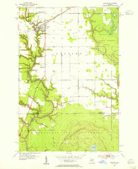
1953 Map of Rudyard
USGS Topo · Published 1955About this map
The community of Rudyard serves as a central hub on this mid-century survey, situated at the intersection of local roads and the Minneapolis St Paul and Sault Ste Marie railroad. This region of the Upper Peninsula is defined by a dense network of waterways, including the North Fork Pine River and Munuscong River, which carve through the terrain. The map captures the spiritual and communal life of the area through landmarks like the Christian Reform Ch and the Apostolic Ch, alongside the S Rudyard Cem to the south. Moving toward the bottom of the sheet, the landscape shifts into protected timberlands within the Marquette National Forest and Munuscong State Forest. These forest boundaries, including a small Quarry and Gravel Pits, highlight the extraction and conservation patterns of the era.
Find a feature on this map
20 named features on this map. Tap any name to fly to it.
Don’t see what you’re looking for? This feature index may not catch every label — zoom into the map to look around manually.
Map Details
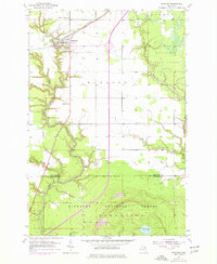
Editions of this 1953 Rudyard Map
2 editions found
Other maps of this area

1913 · Sault Sainte Marie
USGS Topo · 1:62,500

1941 · Sault Sainte Marie
USGS Topo · 1:63,360

1941 · Brimley
USGS Topo · 1:63,360

1951 · Raco
USGS Topo · 1:24,000

1951 · Kinross
USGS Topo · 1:24,000

1951 · Dafter
USGS Topo · 1:24,000

1951 · Brimley
USGS Topo · 1:62,500

1951 · Sault Ste. Marie
USGS Topo · 1:62,500

1953 · Pickford NW
USGS Topo · 1:24,000

1953 · Fibre
USGS Topo · 1:24,000