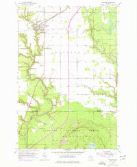
1953 Map of Rudyard
USGS Topo · Published 1977About this map
The agricultural and forested landscape of the Eastern Upper Peninsula is defined here by the settlement of Rudyard, situated at the intersection of the Soo Line railroad and the highway corridor. This 1953 survey, updated with 1970s revisions, illustrates a community deeply tied to its rural institutions, including the Christian Reform Ch and Apostolic Ch. The terrain transitions from the open fields around town to the dense timberlands of the Munuscong State Forest and Hiawatha National Forest, where the topography becomes more pronounced around Marquette. Waterways such as the Pine River and Hiawatha Run carve through the glacial soils, while industrial activity is noted at the southern Gravel Pits. Local genealogists will find the location of the S Rudyard Cem particularly valuable for tracing early families in this Chippewa County region.
Find a feature on this map
19 named features on this map. Tap any name to fly to it.
Don’t see what you’re looking for? This feature index may not catch every label — zoom into the map to look around manually.
Map Details
Editions of this 1953 Rudyard Map
2 editions found
Other maps of this area

1913 · Sault Sainte Marie
USGS Topo · 1:62,500

1941 · Sault Sainte Marie
USGS Topo · 1:63,360

1941 · Brimley
USGS Topo · 1:63,360

1951 · Raco
USGS Topo · 1:24,000

1951 · Kinross
USGS Topo · 1:24,000

1951 · Dafter
USGS Topo · 1:24,000

1951 · Brimley
USGS Topo · 1:62,500

1951 · Sault Ste. Marie
USGS Topo · 1:62,500

1953 · Pickford NW
USGS Topo · 1:24,000
1953 · Rudyard
USGS Topo · 1:24,000