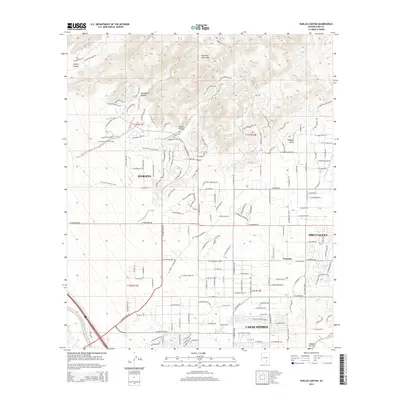
2014 Map of Ruelas Canyon
USGS Topo · Published 2014About this map
The Tortolita Mountains dominate the northern landscape of this Pima County quadrangle, where the high desert terrain transitions into the expanding residential fringes of the Tucson area. In the early 21st century, these slopes are defined by a network of drainage systems including Ruelas Canyon, Cochie Canyon, and Wild Burro Canyon. To the south, the map documents the growth of Marana and the northern reaches of Casas Adobes, showing a sophisticated grid of suburban streets and golf course communities like those near Tortolita. The eastern edge highlights the sophisticated development of Oro Valley and the distinctive La Cholla Airpark. This era is characterized by the integration of recreation and preservation, evidenced by the Tortolita Preserve Loop winding through the foothills between the desert floor and the mountain peaks.
Find a feature on this map
149 named features on this map. Tap any name to fly to it.
Don’t see what you’re looking for? This feature index may not catch every label — zoom into the map to look around manually.
Map Details
Editions of this 2014 Ruelas Canyon Map
This is the sole edition of this map. No revisions or reprints were ever made.
Other maps of this area

1904 · Tucson
USGS Topo · 1:125,000

1905 · Tucson
USGS Topo · 1:125,000

1911 · Winkelman
USGS Topo · 1:125,000

1913 · Winkelman
USGS Topo · 1:125,000

1934 · Tucson Mountains
USGS Topo · 1:125,000

1934 · Newman Peak
USGS Topo · 1:125,000

1947 · Cortaro
USGS Topo · 1:62,500

1956 · Tucson
USGS Topo · 1:250,000

1957 · Cortaro
USGS Topo · 1:62,500
1957 · Tucson North
USGS Topo · 1:24,000