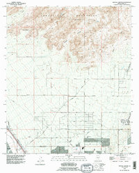
1992 Map of Ruelas Canyon
USGS Topo · Published 1995About this map
Tortolita Mountains dominate the northern landscape of this Pima County region, where steep drainages like Ruelas Canyon and Cochie Canyon give way to the developing desert floor. Near the southern bank of the Santa Cruz River, the small settlement of Maraña sits alongside a Cem and a dedicated Mobile Home Park, representing the localized residential hubs of the early 1990s.
Find a feature on this map
35 named features on this map. Tap any name to fly to it.
Don’t see what you’re looking for? This feature index may not catch every label — zoom into the map to look around manually.
Map Details
Editions of this 1992 Ruelas Canyon Map
This is the sole edition of this map. No revisions or reprints were ever made.
Other maps of this area

1904 · Tucson
USGS Topo · 1:125,000

1905 · Tucson
USGS Topo · 1:125,000

1911 · Winkelman
USGS Topo · 1:125,000

1913 · Winkelman
USGS Topo · 1:125,000

1934 · Tucson Mountains
USGS Topo · 1:125,000

1934 · Newman Peak
USGS Topo · 1:125,000

1947 · Cortaro
USGS Topo · 1:62,500

1956 · Tucson
USGS Topo · 1:250,000

1957 · Cortaro
USGS Topo · 1:62,500
1957 · Tucson North
USGS Topo · 1:24,000