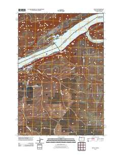
2011 Map of Rufus
USGS Topo · Published 2011About this map
Rufus stands on the southern bank of the Columbia River, positioned near the convergence of major water and canyon routes in Sherman County. The 2011 landscape is dominated by the reservoir of Lake Umatilla and the massive infrastructure of the John Day Dam Fish Ladder, which manages the river's flow and ecology. Inland from the settlement, the terrain is defined by a series of dramatic geographic features including Hellroaring Canyon, Helm Canyon, and Scott Canyon, which funnel seasonal drainage toward the river.
Find a feature on this map
28 named features on this map. Tap any name to fly to it.
Don’t see what you’re looking for? This feature index may not catch every label — zoom into the map to look around manually.
Map Details
Editions of this 2011 Rufus Map
This is the sole edition of this map. No revisions or reprints were ever made.
Other maps of this area

1953 · The Dalles
USGS Topo · 1:250,000

1956 · The Dalles
USGS Topo · 1:250,000

1957 · The Dalles
USGS Topo · 1:250,000

1957 · Wasco
USGS Topo · 1:62,500

1957 · Goldendale
USGS Topo · 1:62,500

1957 · Wishram
USGS Topo · 1:62,500

1957 · Satus Pass
USGS Topo · 1:62,500

1971 · Quinton
USGS Topo · 1:24,000
1971 · Klondike
USGS Topo · 1:24,000

1971 · Rufus
USGS Topo · 1:24,000