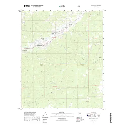
2020 Map of Ruidoso Downs
USGS Topo · Published 2020About this map
Ruidoso Downs and Ruidoso anchor this portion of the high country, where the Rio Ruidoso flows through the northern reaches of the Sacramento Mountains. The landscape is defined by the transition from municipal development to the managed wilderness of the Lincoln National Forest. Local history is preserved at the Stetson Cem near Palo Verde Canyon, while early agricultural infrastructure is evident in the Herrera Ditch tracing the valley floor. High-altitude hydrology is a prominent theme, with named water sources like Hale Lake, Pothole Lake, and various stock tanks such as Blanche Tank scattered across the ridges. To the south, the terrain rises toward Whitetail Mtn, marked by an extensive network of service roads including Indian Svc Rte 18, providing a detailed look at the geography along the Lincoln and Otero County line.
Find a feature on this map
45 named features on this map. Tap any name to fly to it.
Don’t see what you’re looking for? This feature index may not catch every label — zoom into the map to look around manually.
Map Details
Editions of this 2020 Ruidoso Downs Map
This is the sole edition of this map. No revisions or reprints were ever made.
Other maps of this area

1955 · Roswell
USGS Topo · 1:250,000

1958 · Roswell
USGS Topo · 1:250,000

1961 · Lincoln
USGS Topo · 1:62,500

1962 · Roswell
USGS Topo · 1:250,000

1963 · Fort Stanton
USGS Topo · 1:24,000

1963 · Ruidoso Downs
USGS Topo · 1:24,000

1963 · Ruidoso
USGS Topo · 1:24,000

1963 · Angus
USGS Topo · 1:24,000

1963 · Pajarita Mountain
USGS Topo · 1:24,000

1963 · Apache Summit
USGS Topo · 1:24,000