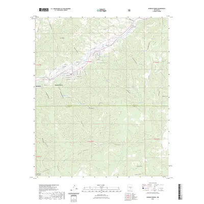
2023 Map of Ruidoso Downs
USGS Topo · Published 2023About this map
Rio Ruidoso flows through a landscape defined by the transition from the high peaks of Sierra Blanca to the canyons of the Sacramento Mountains. The settlement of Ruidoso Downs serves as a focal point, where residential developments like Highlands LN and Escalante DR sit alongside older agricultural infrastructure such as the Herrera Ditch. Much of the area is managed as part of the Lincoln National Forest, where topography is marked by significant drainages including Salsbury Canyon and Palo Verde Canyon.
Find a feature on this map
64 named features on this map. Tap any name to fly to it.
Don’t see what you’re looking for? This feature index may not catch every label — zoom into the map to look around manually.
Map Details
Editions of this 2023 Ruidoso Downs Map
This is the sole edition of this map. No revisions or reprints were ever made.
Other maps of this area

1955 · Roswell
USGS Topo · 1:250,000

1958 · Roswell
USGS Topo · 1:250,000

1961 · Lincoln
USGS Topo · 1:62,500

1962 · Roswell
USGS Topo · 1:250,000

1963 · Fort Stanton
USGS Topo · 1:24,000

1963 · Ruidoso Downs
USGS Topo · 1:24,000

1963 · Ruidoso
USGS Topo · 1:24,000

1963 · Angus
USGS Topo · 1:24,000
1963 · Pajarita Mountain
USGS Topo · 1:24,000

1963 · Apache Summit
USGS Topo · 1:24,000