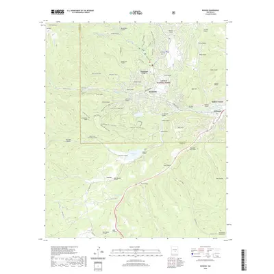
2020 Map of Ruidoso
USGS Topo · Published 2020About this map
Ruidoso serves as the focal point of this 2020 study, situated within the expansive mountain terrain of the Lincoln National Forest. The map documents the community's layout and its relationship with the surrounding wilderness, featuring neighborhoods like Ponderosa Heights and nearby Ruidoso Downs. The Rio Ruidoso and its tributaries, such as Cedar Creek, carve through numerous canyons including Perk Canyon and Paradise Canyon. Notable infrastructure includes the Grindstone Trail (Mine Cany) and the Herrera Ditch, which indicate the area's legacy of resource management and recreation. The proximity of Sierra Blanca and various canyon systems like Miserable Canyon and Airplane Canyon illustrates the complex topography that defines this Lincoln County region. Geographers and local historians can trace the transition from residential areas at Hollywood to the more secluded sites such as Mescalero Lake and Forest Lawn Cem.
Find a feature on this map
86 named features on this map. Tap any name to fly to it.
Don’t see what you’re looking for? This feature index may not catch every label — zoom into the map to look around manually.
Map Details
Editions of this 2020 Ruidoso Map
This is the sole edition of this map. No revisions or reprints were ever made.
Other maps of this area

1950 · Sierra Blanca Peak
USGS Topo · 1:62,500

1950 · Mescalero
USGS Topo · 1:62,500

1955 · Roswell
USGS Topo · 1:250,000

1958 · Roswell
USGS Topo · 1:250,000

1962 · Roswell
USGS Topo · 1:250,000

1963 · Fort Stanton
USGS Topo · 1:24,000

1963 · Ruidoso Downs
USGS Topo · 1:24,000

1963 · Ruidoso
USGS Topo · 1:24,000

1963 · Angus
USGS Topo · 1:24,000

1963 · Apache Summit
USGS Topo · 1:24,000