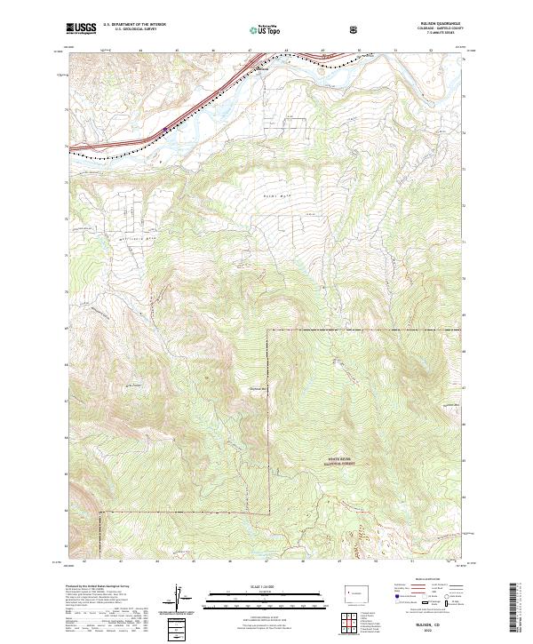
2022 Map of Rulison
USGS Topo · Published 2022About this map
Rulison sits along the northern edge of this Garfield County landscape, positioned between the Colorado River and the rising slopes of the high mesas. The terrain transitions quickly from the irrigated valley floors near Sharrard Park to the elevated benches of Holms Mesa and Morrisania Mesa. This area is characterized by a complex network of drainage systems including Cottonwood Cr and Battlement Cr, which have carved deep features such as Monument Gulch into the plateau.
Find a feature on this map
53 named features on this map. Tap any name to fly to it.
Don’t see what you’re looking for? This feature index may not catch every label — zoom into the map to look around manually.
Map Details
Editions of this 2022 Rulison Map
This is the sole edition of this map. No revisions or reprints were ever made.
Other maps of this area

1906 · Grand Hogback
USGS Topo · 1:125,000

1910 · Grand Hogback
USGS Topo · 1:125,000

1925 · Parachute Creek
USGS Topo · 1:62,500

1927 · Parachute Creek
USGS Topo · 1:62,500

1929 · Grand Valley
USGS Topo · 1:62,500

1952 · Anvil Points
USGS Topo · 1:24,000

1952 · Rifle
USGS Topo · 1:24,000

1956 · Grand Junction
USGS Topo · 1:250,000

1957 · Leadville
USGS Topo · 1:250,000

1959 · Grand Junction
USGS Topo · 1:250,000