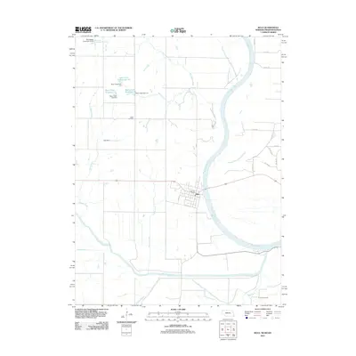
2011 Map of Rulo
USGS Topo · Published 2011About this map
The Missouri River defines the eastern boundary of this Nebraska-Missouri-Kansas borderland, winding alongside the town of Rulo in Richardson County. This survey shows a landscape heavily influenced by water management, featuring a series of reservoirs and dams such as Bean Creek Reservoir 5-5, Bean Creek Dam 5-4, and Frost Reservoir. These structures, along with the confluence of the Big Nemaha River and the Missouri, illustrate the hydrological engineering essential to the region's agricultural and flood-control history.
Find a feature on this map
36 named features on this map. Tap any name to fly to it.
Don’t see what you’re looking for? This feature index may not catch every label — zoom into the map to look around manually.
Map Details
Editions of this 2011 Rulo Map
This is the sole edition of this map. No revisions or reprints were ever made.
Other maps of this area

1885 · Atchison
USGS Topo · 1:125,000

1888 · Atchison
USGS Topo · 1:125,000

1888 · Hiawatha
USGS Topo · 1:125,000

1893 · Atchison
USGS Topo · 1:125,000

1894 · Hiawatha
USGS Topo · 1:125,000

1915 · Falls City
USGS Topo · 1:62,500

1920 · Craig
USGS Topo · 1:62,500

1950 · Kansas City
USGS Topo · 1:250,000

1954 · Kansas City
USGS Topo · 1:250,000

1955 · Nebraska City
USGS Topo · 1:250,000