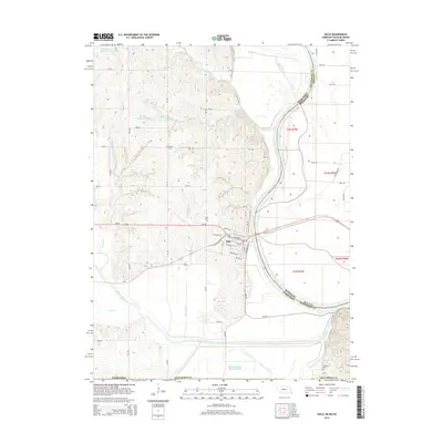
2014 Map of Rulo
USGS Topo · Published 2014About this map
Rulo sits at a geographic crossroads in southeastern Richardson County, where the Missouri River defines the border between Nebraska and Missouri. The village's street grid, including Broadway St and Rouleau St, is positioned just north of where the Big Nemaha River joins the Missouri. The landscape is deeply carved by drainage systems like Canada Creek and Mooney Creek, while the presence of the Old Channel Big Nemaha River suggests significant historical hydrological changes and flood control efforts in the river valley.
Find a feature on this map
55 named features on this map. Tap any name to fly to it.
Don’t see what you’re looking for? This feature index may not catch every label — zoom into the map to look around manually.
Map Details
Editions of this 2014 Rulo Map
This is the sole edition of this map. No revisions or reprints were ever made.
Other maps of this area

1885 · Atchison
USGS Topo · 1:125,000

1888 · Atchison
USGS Topo · 1:125,000

1888 · Hiawatha
USGS Topo · 1:125,000

1893 · Atchison
USGS Topo · 1:125,000

1894 · Hiawatha
USGS Topo · 1:125,000

1915 · Falls City
USGS Topo · 1:62,500

1920 · Craig
USGS Topo · 1:62,500

1950 · Kansas City
USGS Topo · 1:250,000

1954 · Kansas City
USGS Topo · 1:250,000

1955 · Nebraska City
USGS Topo · 1:250,000