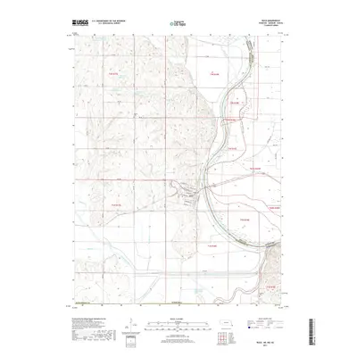
2017 Map of Rulo
USGS Topo · Published 2017About this map
The Missouri River defines the eastern boundary of this region, where the state lines of Nebraska, Kansas, and Missouri converge. Near the river's winding path, the settlement of Rulo is laid out in a grid of streets including Broadway St and Commercial St. The hydrology of Richardson County is highly complex, featuring the Big Nemaha River and its Old Channel, along with various reservoirs like Winnebago Cr Reservoir 22-3A and several along Bean Cr. For those researching family history in the area, the map marks the Franklin Cem and Heater Cem. The landscape is a network of rural routes such as Richardson Co Rd and various numeric designations like 660 Blvd, tracing the upland drainage systems of Canada Cr, Mooney Cr, and Snake Cr.
Find a feature on this map
60 named features on this map. Tap any name to fly to it.
Don’t see what you’re looking for? This feature index may not catch every label — zoom into the map to look around manually.
Map Details
Editions of this 2017 Rulo Map
This is the sole edition of this map. No revisions or reprints were ever made.
Other maps of this area

1885 · Atchison
USGS Topo · 1:125,000

1888 · Atchison
USGS Topo · 1:125,000

1888 · Hiawatha
USGS Topo · 1:125,000

1893 · Atchison
USGS Topo · 1:125,000

1894 · Hiawatha
USGS Topo · 1:125,000

1915 · Falls City
USGS Topo · 1:62,500

1920 · Craig
USGS Topo · 1:62,500

1950 · Kansas City
USGS Topo · 1:250,000

1954 · Kansas City
USGS Topo · 1:250,000

1955 · Nebraska City
USGS Topo · 1:250,000