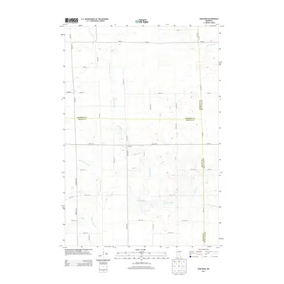
2013 Map of Rum River
USGS Topo · Published 2013About this map
The W Br Rum River and Rum River flow through this section of central Minnesota, defining a landscape where the boundaries of Morrison, Benton, and Mille Lacs counties converge. The hydrology of the region is further detailed by the Saint Francis River in the southwest and smaller tributaries like Stony Brook and Tibbetts Brook. This 2013 survey illustrates a rural grid of township roads such as Nature Rd and Ronneby Rd NE that navigate the wetland-rich terrain typical of the area north of Ronneby and Foley. The map captures the subtle elevation changes and numerous small depressions that characterize this glaciated river basin before the modern expansion of these rural corridors.
Find a feature on this map
39 named features on this map. Tap any name to fly to it.
Don’t see what you’re looking for? This feature index may not catch every label — zoom into the map to look around manually.
Map Details
Editions of this 2013 Rum River Map
This is the sole edition of this map. No revisions or reprints were ever made.
Other maps of this area

1953 · Stillwater
USGS Topo · 1:250,000

1955 · Stillwater
USGS Topo · 1:250,000

1958 · Stillwater
USGS Topo · 1:250,000

1965 · Stillwater
USGS Topo · 1:250,000

1968 · Ramey NE
USGS Topo · 1:24,000
1968 · Foley
USGS Topo · 1:24,000
1968 · Ramey NW
USGS Topo · 1:24,000

1968 · Rum River
USGS Topo · 1:24,000
1968 · Ramey
USGS Topo · 1:24,000

1968 · Milaca
USGS Topo · 1:24,000