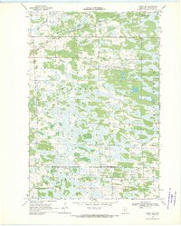
1968 Map of Ramey NW
USGS Topo · Published 1970About this map
Hillman Creek meanders through the northern reaches of this central Minnesota landscape, defining a terrain largely shaped by its marshy depressions and township divisions. Surveyed in the late 1960s, the area is organized into distinct jurisdictions including Granite, Leigh, and Hillman, with the Hillman Corp Bdy marking the edge of local settlement. The map reveals a rural infrastructure reliant on localized extraction and early educational outposts, evidenced by scattered Gravel Pits and the isolated School No 1220. A prominent Pipeline cuts across the southern townships of Morrill and Mount Morris, highlighting the mid-century industrial transit that moved through this agricultural and wetland region.
Find a feature on this map
11 named features on this map. Tap any name to fly to it.
Don’t see what you’re looking for? This feature index may not catch every label — zoom into the map to look around manually.
Map Details
Editions of this 1968 Ramey NW Map
This is the sole edition of this map. No revisions or reprints were ever made.
Other maps of this area

1948 · Pierz
USGS Topo · 1:62,500

1948 · Lastrup
USGS Topo · 1:62,500

1950 · Lastrup
USGS Topo · 1:62,500

1950 · Pierz
USGS Topo · 1:62,500

1953 · Duluth
USGS Topo · 1:250,000

1953 · Brainerd
USGS Topo · 1:250,000

1953 · Saint Cloud
USGS Topo · 1:250,000

1953 · Stillwater
USGS Topo · 1:250,000

1955 · Stillwater
USGS Topo · 1:250,000

1957 · Brainerd
USGS Topo · 1:250,000