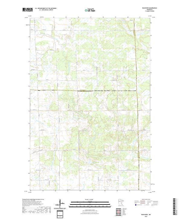
2022 Map of Rum River
USGS Topo · Published 2022About this map
The W Br Rum River meanders through this portion of central Minnesota, defining a landscape of low-lying wetlands and creek systems. This rural environment is shaped by the transition between several drainage basins, where Tibbetts Brook and Stony Brook contribute to the larger riparian network. The map reveals a strictly rectangular grid of section lines and gravel roads, such as Nature Rd and 78th St, which overlay a complex patchwork of marshes and seasonal water bodies. This interplay between the rigid township-and-range surveying system and the fluid, organic paths of the Saint Francis River and Estes Brook illustrates the challenges of early land development in this part of the state. It is a sparsely populated area where the primary landmarks are the intersections of county routes like Co Hwy 33 and Co Rd 32.
Find a feature on this map
39 named features on this map. Tap any name to fly to it.
Don’t see what you’re looking for? This feature index may not catch every label — zoom into the map to look around manually.
Map Details
Editions of this 2022 Rum River Map
This is the sole edition of this map. No revisions or reprints were ever made.
Other maps of this area

1953 · Stillwater
USGS Topo · 1:250,000

1955 · Stillwater
USGS Topo · 1:250,000

1958 · Stillwater
USGS Topo · 1:250,000

1965 · Stillwater
USGS Topo · 1:250,000

1968 · Ramey NE
USGS Topo · 1:24,000
1968 · Foley
USGS Topo · 1:24,000
1968 · Ramey NW
USGS Topo · 1:24,000

1968 · Rum River
USGS Topo · 1:24,000
1968 · Ramey
USGS Topo · 1:24,000

1968 · Milaca
USGS Topo · 1:24,000