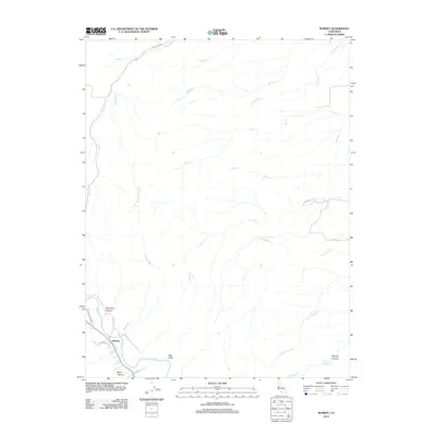
2012 Map of Rumsey
USGS Topo · Published 2012About this map
The settlement of Rumsey sits along the banks of Cache Cr in this northern California canyon landscape. Located in northwestern Yolo County, the area is defined by a series of dramatic geographic markers including the Blue Cliffs and several deeply cut drainages such as Benjamin Canyon and Reiff Canyon. The map reveals a network of rural routes, including Rumsey Canyon Rd and Co Rd 41, which follow the natural contours of the watercourses.
Find a feature on this map
26 named features on this map. Tap any name to fly to it.
Don’t see what you’re looking for? This feature index may not catch every label — zoom into the map to look around manually.
Map Details
Editions of this 2012 Rumsey Map
This is the sole edition of this map. No revisions or reprints were ever made.
Other maps of this area

1905 · Harrington
USGS Topo · 1:24,000

1907 · Colusa
USGS Topo · 1:62,500

1916 · Harrington
USGS Topo · 1:31,680

1918 · Spring Valley
USGS Topo · 1:31,680
1918 · Arbuckle
USGS Topo · 1:31,680

1920 · Venado
USGS Topo · 1:62,500

1942 · Colusa
USGS Topo · 1:62,500

1943 · Morgan Valley
USGS Topo · 1:62,500

1944 · Wilbur Springs
USGS Topo · 1:62,500

1944 · Morgan Valley
USGS Topo · 1:62,500