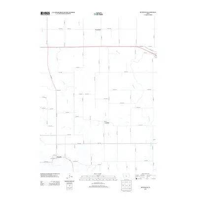
2013 Map of Runnells
USGS Topo · Published 2013About this map
Runnells anchors the southwestern corner of this Iowa landscape, where the modern road network intersects with longstanding agricultural settlements. The terrain is defined by the drainage patterns of Camp Cr and Walnut Cr, which carve through the grid of section lines and county roads. Further north and east, the small communities of Vandalia and Prairiebell represent the traditional clusters of rural life in Polk County. This 2013 survey illustrates the shift in regional transportation, showing the alignment of 163 alongside Old Ia 163 and Poplar Ave. The presence of named water features like Mill Br suggests the early importance of local streams for drainage or industry in this prairie environment, providing a clear record of the intersection between natural hydrology and the rectilinear human development typical of the American Midwest.
Find a feature on this map
70 named features on this map. Tap any name to fly to it.
Don’t see what you’re looking for? This feature index may not catch every label — zoom into the map to look around manually.
Map Details
Editions of this 2013 Runnells Map
This is the sole edition of this map. No revisions or reprints were ever made.
Other maps of this area

1909 · Knoxville
USGS Topo · 1:62,500

1910 · Milo
USGS Topo · 1:62,500

1912 · Knoxville
USGS Topo · 1:62,500

1930 · Mitchellville
USGS Topo · 1:62,500

1954 · Des Moines
USGS Topo · 1:250,000

1956 · Des Moines
USGS Topo · 1:250,000

1957 · Des Moines
USGS Topo · 1:250,000

1965 · Pleasantville
USGS Topo · 1:24,000

1965 · Prairie City
USGS Topo · 1:24,000

1965 · Knoxville NW
USGS Topo · 1:24,000