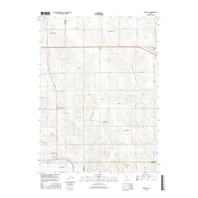
2015 Map of Runnells
USGS Topo · Published 2015About this map
The town of Runnells anchors the southwestern portion of this central Iowa landscape, positioned near the junction of Polk, Jasper, and Marion counties. This 2015 survey details a predominantly agricultural corridor where the small settlements of Vandalia and Prairie City are connected by a network of rural roads such as NE 12th Ave and Co Rd F70. The terrain is defined by the drainage patterns of Camp Cr and Walnut Cr, which carve through the till plains. For those researching local history or genealogy, the map identifies several rural burying grounds including Lowman Cem, Vandalia Cem, and Prairie Belle Cem. Modern land use is visible in the presence of the Tallgrass Trail, while the underlying Public Land Survey System (PLSS) grid, including sections of t78n r21w, continues to dictate the local road and property boundaries.
Find a feature on this map
48 named features on this map. Tap any name to fly to it.
Don’t see what you’re looking for? This feature index may not catch every label — zoom into the map to look around manually.
Map Details
Editions of this 2015 Runnells Map
This is the sole edition of this map. No revisions or reprints were ever made.
Other maps of this area

1909 · Knoxville
USGS Topo · 1:62,500

1910 · Milo
USGS Topo · 1:62,500

1912 · Knoxville
USGS Topo · 1:62,500

1930 · Mitchellville
USGS Topo · 1:62,500

1954 · Des Moines
USGS Topo · 1:250,000

1956 · Des Moines
USGS Topo · 1:250,000

1957 · Des Moines
USGS Topo · 1:250,000

1965 · Pleasantville
USGS Topo · 1:24,000

1965 · Prairie City
USGS Topo · 1:24,000

1965 · Knoxville NW
USGS Topo · 1:24,000