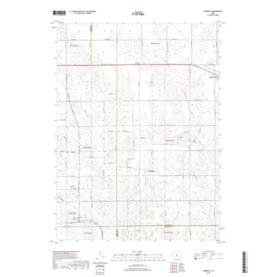
2018 Map of Runnells
USGS Topo · Published 2018About this map
Runnells and the surrounding agricultural landscapes of Polk, Jasper, and Marion counties are captured here in this late-decade survey. The terrain is defined by the drainage basins of Camp Creek and Walnut Cr, where the transition from rolling upland fields to wooded creek bottoms creates a distinct patchwork of land use. The map provides significant detail for local historians, documenting several burial grounds including Prairie Belle Cem to the north and Vandalia Cem near the settlement of Vandalia.
Find a feature on this map
53 named features on this map. Tap any name to fly to it.
Don’t see what you’re looking for? This feature index may not catch every label — zoom into the map to look around manually.
Map Details
Editions of this 2018 Runnells Map
This is the sole edition of this map. No revisions or reprints were ever made.
Other maps of this area

1909 · Knoxville
USGS Topo · 1:62,500

1910 · Milo
USGS Topo · 1:62,500

1912 · Knoxville
USGS Topo · 1:62,500

1930 · Mitchellville
USGS Topo · 1:62,500

1954 · Des Moines
USGS Topo · 1:250,000

1956 · Des Moines
USGS Topo · 1:250,000

1957 · Des Moines
USGS Topo · 1:250,000

1965 · Pleasantville
USGS Topo · 1:24,000

1965 · Prairie City
USGS Topo · 1:24,000

1965 · Knoxville NW
USGS Topo · 1:24,000