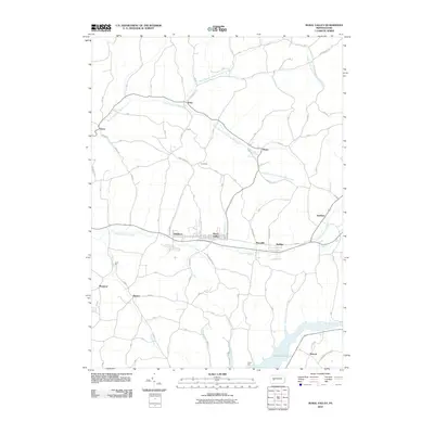
2010 Map of Rural Valley
USGS Topo · Published 2010About this map
Rural Valley and the neighboring industrial settlement of Yatesboro serve as the primary hubs in this Armstrong County landscape. The community layout follows the path of Cowanshannock Creek, which runs east-to-west across the central portion of the map. This area is characterized by a high density of small named hamlets and junctions, including NuMine, Meredith, and Smeltzer, illustrating the tightly packed settlement pattern common in western Pennsylvania's valley corridors.
Find a feature on this map
34 named features on this map. Tap any name to fly to it.
Don’t see what you’re looking for? This feature index may not catch every label — zoom into the map to look around manually.
Map Details
Editions of this 2010 Rural Valley Map
This is the sole edition of this map. No revisions or reprints were ever made.
Other maps of this area

1901 · Rural Valley
USGS Topo · 1:62,500

1902 · Indiana
USGS Topo · 1:62,500

1902 · Elders Ridge
USGS Topo · 1:62,500

1903 · Rural Valley
USGS Topo · 1:62,500

1904 · Elders Ridge
USGS Topo · 1:62,500

1909 · Smicksburg
USGS Topo · 1:62,500

1938 · Smicksburg
USGS Topo · 1:62,500

1939 · Smicksburg
USGS Topo · 1:62,500

1953 · Pittsburgh
USGS Topo · 1:250,000

1954 · Pittsburgh
USGS Topo · 1:250,000