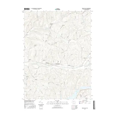
2016 Map of Rural Valley
USGS Topo · Published 2016About this map
Rural Valley and the neighboring community of Yatesboro anchor this Armstrong County landscape, where the deeply dissected terrain of the Allegheny Plateau is carved by the waters of Cowanshannock Creek. The map reveals a dense network of local history markers, particularly seen in the numerous small family and parish burial grounds that dot the ridges and valleys, including the Schrecengost Farm Cemetery and Elgin Old Presbyterian Cemetery.
Find a feature on this map
44 named features on this map. Tap any name to fly to it.
Don’t see what you’re looking for? This feature index may not catch every label — zoom into the map to look around manually.
Map Details
Editions of this 2016 Rural Valley Map
This is the sole edition of this map. No revisions or reprints were ever made.
Other maps of this area

1901 · Rural Valley
USGS Topo · 1:62,500

1902 · Indiana
USGS Topo · 1:62,500

1902 · Elders Ridge
USGS Topo · 1:62,500

1903 · Rural Valley
USGS Topo · 1:62,500

1904 · Elders Ridge
USGS Topo · 1:62,500

1909 · Smicksburg
USGS Topo · 1:62,500

1938 · Smicksburg
USGS Topo · 1:62,500

1939 · Smicksburg
USGS Topo · 1:62,500

1953 · Pittsburgh
USGS Topo · 1:250,000

1954 · Pittsburgh
USGS Topo · 1:250,000